What to expect from Carolina winter storm (Recorded Saturday night)
b'
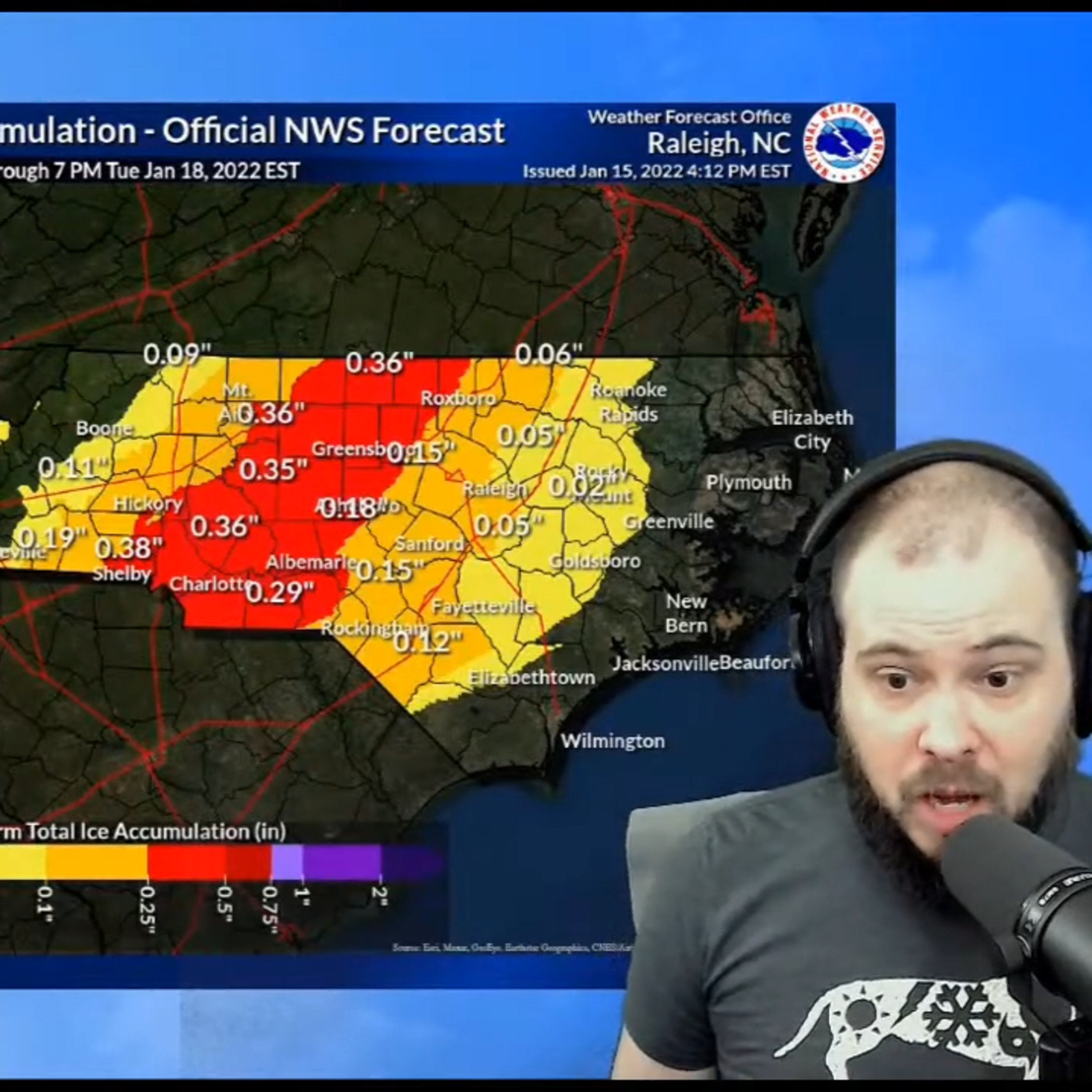
The biggest winter storm to impact the Carolinas since 2018 is nearly here.
\\nThe National Weather Service has issued Winter Storm Warnings and Ice Storm Warnings for portions of the Carolinas.
\\nLocations to be most impacted by this winter storm include, but are not limited to: Charlotte, Greensboro, Winston-Salem, High Point, Boone, Blowing Rock, Hickory, Ashville, Spartanburg, and Greenville.
\\nThe winter storm moves into North Carolina and South Carolina Saturday night, bringing ice, snow, sleet, and freezing rain to the Carolinas.
\\nThe mountains of western North Carolina, including Asheville, could see up to a foot of snow. While the piedmont of the Carolinas, including Charlotte and Greensboro, could bring upwards of two inches.
\\nThe biggest threat could come from ice across Charlotte, Rock Hill, Fort Mill, Matthews, Monroe, Mint Hill, Cheraw, and Lancaster
\\nIce has the potential to bring down power lines and tree branches.
\\n\\n\\n